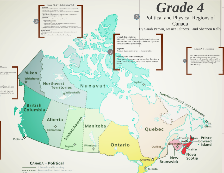
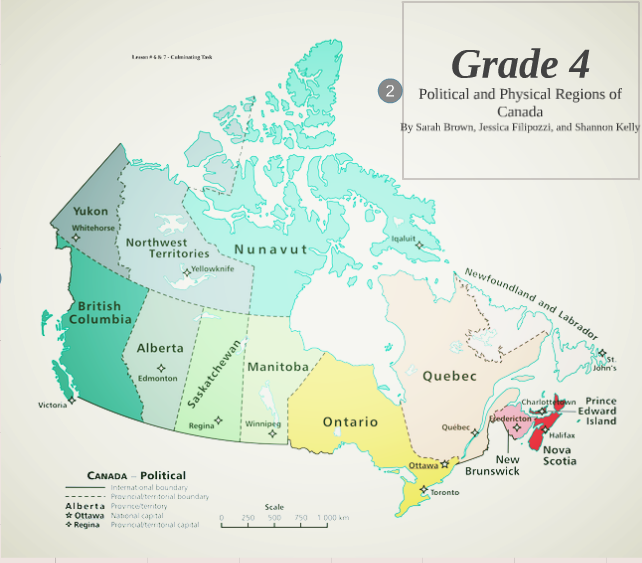
Social Studies can be made fun for all ages and can incorporate a lot of hands on activities that will allow students to grasp a better understanding of content. Grade fours begin to learn the physical and political regions of Canada. Visit our Prezi, where we created a unit based on B3. Understanding Context: identify Canada's political and physical regions, and describe their main characteristics and some significant activities that take place in them.
This unit scaffolds 4 lessons with a culminating task at the end to ensure that grade four students have not only understood what the political and physical regions are within Canada, but they are able to apply their knowledge in a meaningful manner. All lessons have an engaging portion that allows students to get hands on with the material -- which I believe is vital for student learning.
This unit scaffolds 4 lessons with a culminating task at the end to ensure that grade four students have not only understood what the political and physical regions are within Canada, but they are able to apply their knowledge in a meaningful manner. All lessons have an engaging portion that allows students to get hands on with the material -- which I believe is vital for student learning.
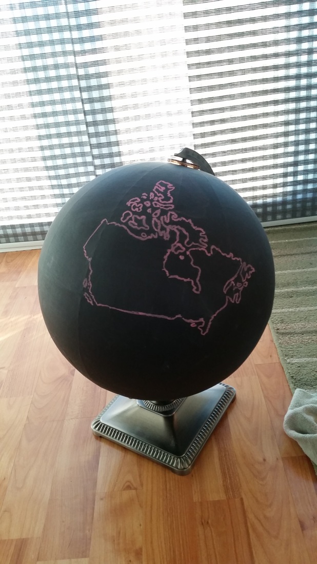
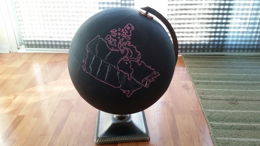
The chalk globe can be used int he classroom for a variety of lessons and fun activities. In my lesson from the unit I chose to use it in my Minds On portion of my lesson plan. The students were asked to work together to draw where they thought the boundaries for each province and territory were located within Canada. This activated their prior knowledge with looking at the boundaries. Throughout the lesson the students were familiarized with the boundaries and the with consolidation, the students revisited another outline of Canada and asked to redraw their lines. The two outlines can be compared to see their knowledge of the boundaries before and after the lesson. The teacher can analyze whether the students are taking away the content that is intended and shows whether the students are grasping the boundaries correctly. The chalk globe can also be used in a lesson where they are learning the capital cities and student can be asked to locate and label each city.
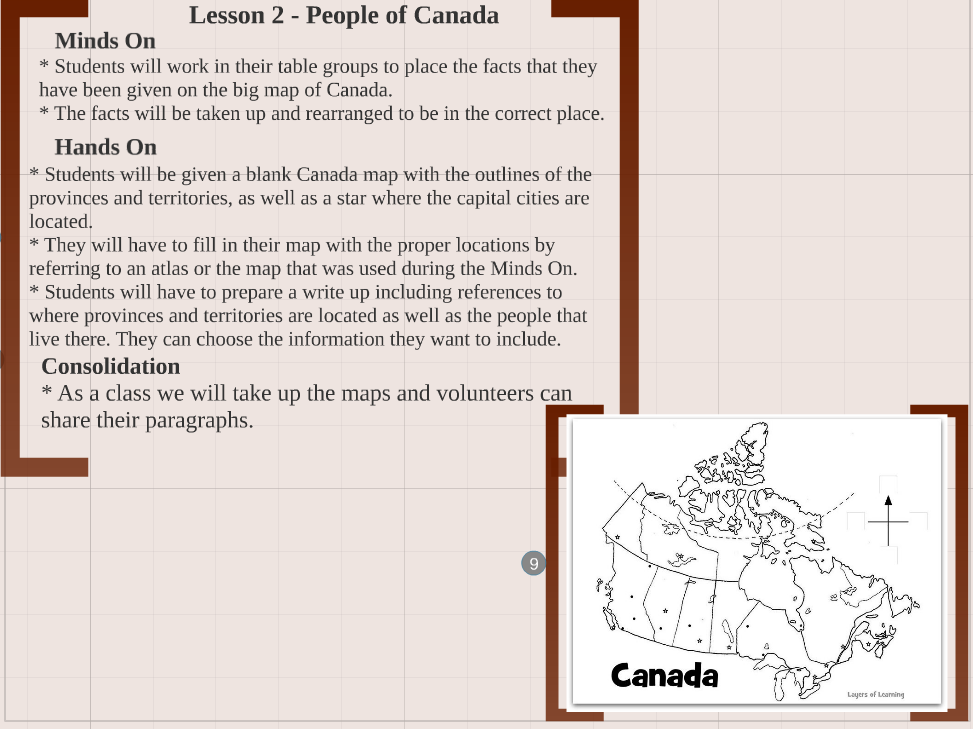
The students were given facts about a specific province or territory within Canada and as a group they had to decide which province they thought it was about. Students would stick their fact on the map and together as a class the results were taken up. This allowed for discussion to take place, students were able to express why they think the fact belongs there and how they know this. This activity gets students thinking about how each province and territory is different from each on the basis of people. They will have learned how they are physically different but they will learn what peoples make up each province.
The students were given facts about a specific province or territory within Canada and as a group they had to decide which province they thought it was about. Students would stick their fact on the map and together as a class the results were taken up. This allowed for discussion to take place, students were able to express why they think the fact belongs there and how they know this. This activity gets students thinking about how each province and territory is different from each on the basis of people. They will have learned how they are physically different but they will learn what peoples make up each province.
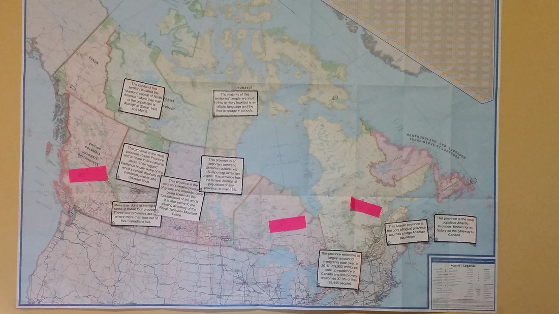
These were the facts I included for the mapping activity..
(Government of Canada, 2014)
- This Atlantic province is the only bilingual province and has a large Acadian population. (New Brunswick)
- This province welcomes the largest amount of immigrants each year. In 2015, 239,800 immigrants took up residence in Canada and this province welcomed 37.3% of them (89,445 people). (Ontario)
- The majority of this territories’ people are Inuit. In this territory Inuktitut is an official language and the first language in schools. (Nunavut
- More than 85% of immigrants settle in these four provinces. These four provinces are also where more than four out of five Canadians live. (Ontario, Quebec, Alberta, and British Columbia)
- This province is the most populous Atlantic Province. Known for its history as the gateway to Canada . (Nova Scotia)
- This province is an important centre to Ukrainian culture, with 14% reporting Ukrainian origins. This province has the largest Aboriginal population of any province, at over 15%. (Manitoba)
- This province is the most populous Prairie Province and is home to five national parks. Their rugged Badlands house some of the world’s richest deposits of prehistoric fossils and dinosaur finds. (Alberta)
- The capital of this territory is called the “diamond capital of North America”. More than half of the population is Aboriginal (Dene, Inuit and Métis). (Northwest Territories)
- This province is the country’s largest producer of grains and oilseeds, once being known as the “breadbasket of the world”. It is also home to the training academy of the Royal Canadian Mounted Police. (Saskatchewan)
(Government of Canada, 2014)
